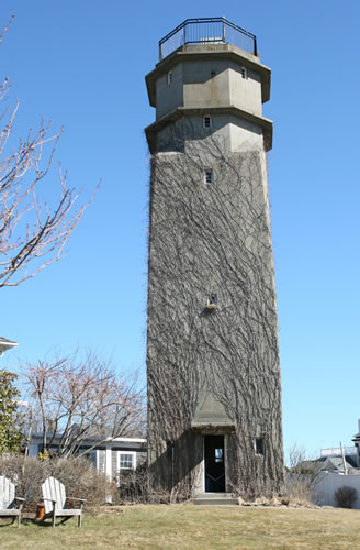
Point Allerton Tall Fire Control Tower
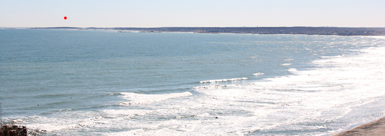
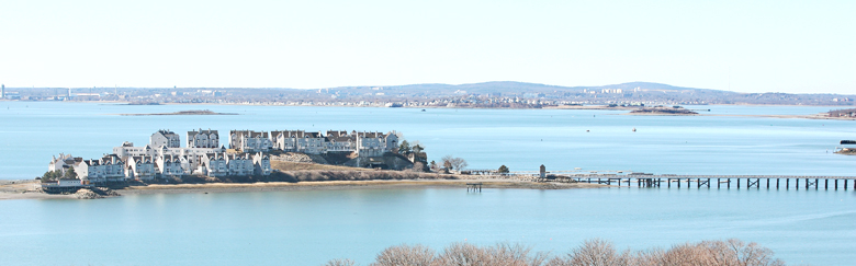
This 7-story tower is perhaps the most impressive asset in the entire Boston Harbor Defense fire control system. It survives in almost mint condition in the back yard of a private residence, is visible throughout the town of Hull, and offers Boston's most breathtaking view of the harbor.
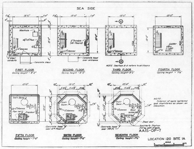
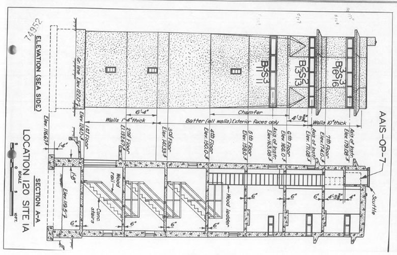
The top three stories of this tower were used for observation, and each was equipped with a DPF (Depression Position Finder) spotting instrument. The top-story instrument, at 179 feet, controlled fire for Battery Murphy, the 16-inch guns in Nahant. This was the highest elevation of any observation instrument in the Boston Harbor defenses. Next came the 6th story, at 171 feet (still higher than other Boston stations) which controlled Battery Jewell, the 6-inch guns on nearby Outer Brewster Island. Then came the fith story, at 163 feet, which controlled fire for Battery 207, the 6-inch guns (not installed until after WW2) Fort Dawes, on the other side of the harbor entrance.
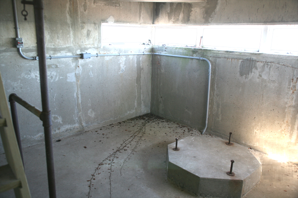
The current owner, who has lived in the nearby house for more than 10 years, was kind enough to let me visit the tower, including its roof. The most remarkable feature inside is the survival of the hexagonal concrete pads that were used on the top three levels to mount the observation instruments.
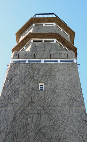
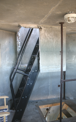
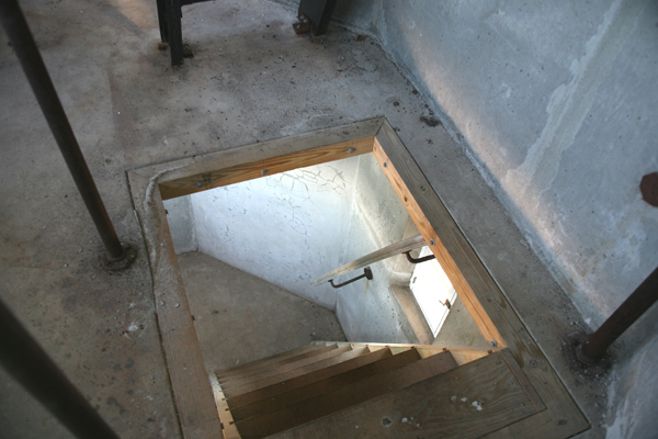
A reinforced concrete "crow's nest" (sort of a concrete "bucket") was tucked into the back of the 7th story. This held the anti-aircraft observer ( AAIS-OP-7), who reached his post by climbing a very small ladder to the crow's nest and opened a trapdoor in the roof to raise his head and shoulders above roof level. The railing that now surrounds the roof would have been no obsruction to his view, since this was added by the current owner to make the roof safer to occupy.
The tower had a chamfered design, called "ornimental"by the Army Engineers, which was unique in the Boston harbor fire control network: the corners of the top two stories of the tower were carved away to give them a hexagononal plan. It is doubtful that this design flair did anything to "camouflage" the tower. Local rumor has it that an underground passage ran from the tower easterly toward the lower fire control buildings nearer the sea, but there is no evidence on the plans for this.
Piping for the boiler that used to heat the tower is evident on the 1st floor, but the heating system has now been removed. The original electrical wiring has also been replaced with modern circuitry.
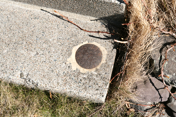
Another unusual feature is the survival of the geodetic disk (MY4604) that was emplaced in the concrete roof to mark the precise latitude and longitude of the center of the pintles of the DPF instruments on the top three stories. Usually, these disks get covered with tar or roofing materials or, in the more remote towers, have been pried loose by marauders.
A second geodetic disk (MY0126), one of the iron variety used during the WW2 years as a way of conserving scarce brass, is also located at the tower, emplaced on the southerly end of the step up to the tower door.
A third marker (MY4601), a drill hole in a concrete pillar set in 1940, probably as part of the initial surveys that preceeded the construction of the tower, is located about 1,000 ft.farther to the north, out on the tip of the Point, about 10 ft. from the drop off from the lawns of the houses there to the seawall below that protects the bluff.