coast defense

Masthead Image

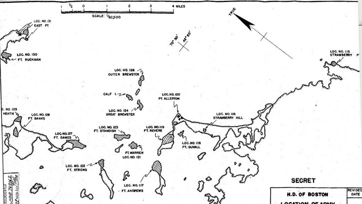
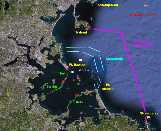
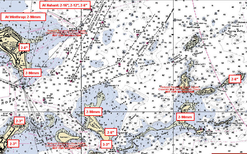
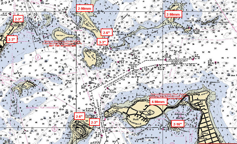
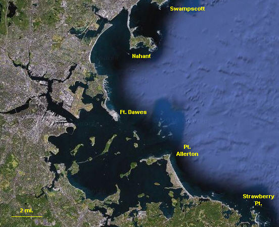
Boston Harbor Overview: Layers of Defense

included Under the .sLorem ipsum dolor sit amet, consectetuer adipiscing elit. Quisque congue tristique eros. Nulla facilisi. Quisque sem mauris, ullamcorper ac, gravida id, mattis id, sapien. Nullam adipiscing enim dapibus felis. Fusce a nisi in odio pulvinar fringilla.

Boston Harbor Maps and Charts

  • General Orientation Map
    This map covers the core area of the harbor defenses, within a line about 16 miles long between Swampscott and Strawberry Point. The system of fire control towers and searchlights extends much farther up and down the coast. (Base map from Google Maps)
  • Principal Gun Sites (Inner)
    This map identifies the principal gun sites of the harbor, excepting Nahant. Most of these are located on harbor islands, but are generally identified by the names of the forts on these islands. (base map from Google Maps)
  • Harbor Map
    This map, from the 1945 report of Harbor Defenses, shows the overlap of the various named islands, the forts, and the Location numbers used by the Army to identify these sites.
  • Overview Of Defensive Layers
    This map shows a schematic of the layers of Boston's harbor defense. The red dots indicate the general location of the 21 batteries of guns defending the harbor (47 guns of 3-inch caliber or larger). Minefields and surface/sub marine barriers are shown, as well as the channel ASDIC sound detectors. Fianally there were the outer magnetic indicator loops to detect approaching traffic. (Base map from Google Maps)
  • Channel North Guns
    This contemporary (1998) map of the northern channels into Boston Harbor shows the general location of the batteries of guns over 3-inches in size on the northern side of the harbor. Some of these batteries are repeated on the mao of the southern side. (base chart from NOAA)
  • Channel South Guns
    This contemporary (1998) map of the southenr channels into Boston Harbor shows the general location of the batteries of guns over 3-inches in size on the southern side of the harbor. Some of these batteries are repeated on the map of the northern side. (base chart from NOAA)