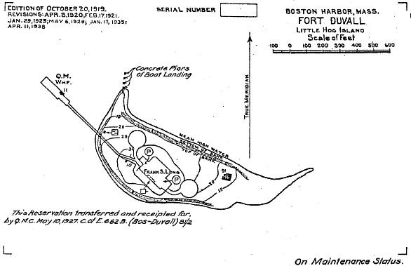
Fort Duvall
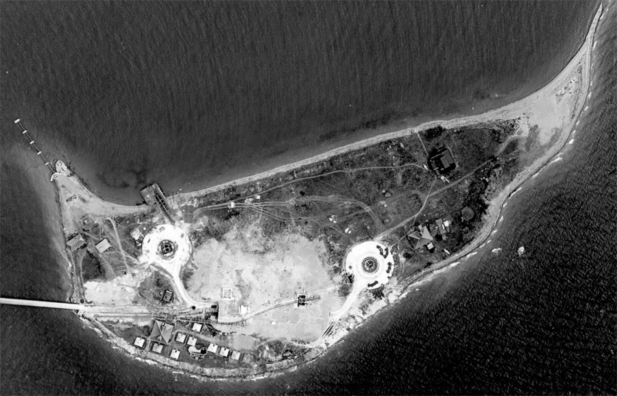
The land for Fort Duvall was acquired in 1917, and comprised the entire 9.45 acres of what was at that time known as Hog Island, lying in Hull Bay, just south of the western "forearm" of the Nantasket Peninsula (and Fort Revere).
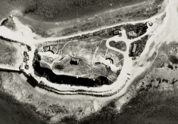
Fort Duvall had only one purpose: to serve as the site for a battery of big guns, later to be named Battery Long, defending the southern approaches to Boston Harbor. Accomplishing this, however, was a lengthy endeavor, with several false starts.
According to an account by Glen Williford, the coast defense commander for Boston recommended, in September, 1915, that four 12-inch mortars be placed on Hog Island, to provide close-in defense for the southern one of the two 16-inch batteries that were being planned, the one at "Scituate Neck" (now referred to as Minot). [The location suggested for these guns was perhaps the peninsula called Strawberry Point, an advantageous position later used for a cluster of four fire control structures during WW2.]
But, the Army then decided on only one battery of 16-inch guns for the harbor, and debate ensued about its location. (Calf Island and Great Brewster Island, among the outer Harbor Islands, were competitors.) At this time, the batteries at Nahant (Battery Gardner) and Hog Island (Battery Long) were re-designated for the long-range 12-inch guns M1895 A2 on barbette carriages (M1917 BC) .
Nahant's guns were funded first, in 1917, and those for Hog Island followed in 1919. During construction of both batteries, however, the Army became interested in installing the new M1919 16-inch BC guns (instead of the 12-inchers) at Hog Island. Simultaneously, it became clear that the cost of building and operating a 16-inch battery on one of the outer Harbor Islands would be high, so these guns were designated for Hog Island instead. Still, because the Army could not make a final decision on the 12-inch vs. the 16-inch options at both sites, these became the only batteries in the United States to have both types of base rings and anchor bolts included in their construction. Final work on Battery Long (again, according to Williford's research) commenced in August, 1923, and was completed in 1925.
During the late 1920s and then in the 1930s, only a small caretaker staff inhabited Hog Island. The Coast Artillery troops who sometimes manned Battery Long, in an arrangement unique in Boston Harbor, were quartered at nearby Fort Revere (which was by then otherwise largely disused).
It is possible that siting the 16-inch guns of Battery Long farther out in the harbor, on an uninhabited island, might have been preferable (though much more expensive), since Battery Long on Hog Island was kept largely silent, because firing its guns would have disturbed too many nearby residents. The battery was allowed to fire on only two occasions (in August and September, 1942). The Boston Daily Globe reported that before both these tests, 3000 and 2000 Hull residents, respectively, were evacuated from town by the Army. which was probably trying to avoid protests from the populace and concussion damage to nearby homes.