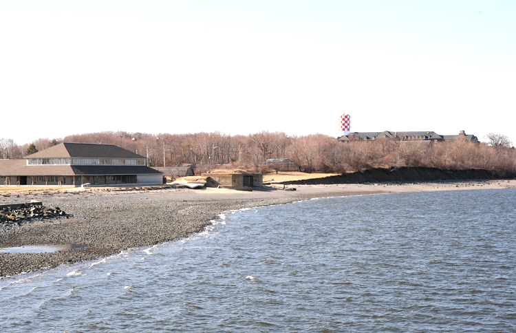
coast defense

Masthead Image

Fort Strong

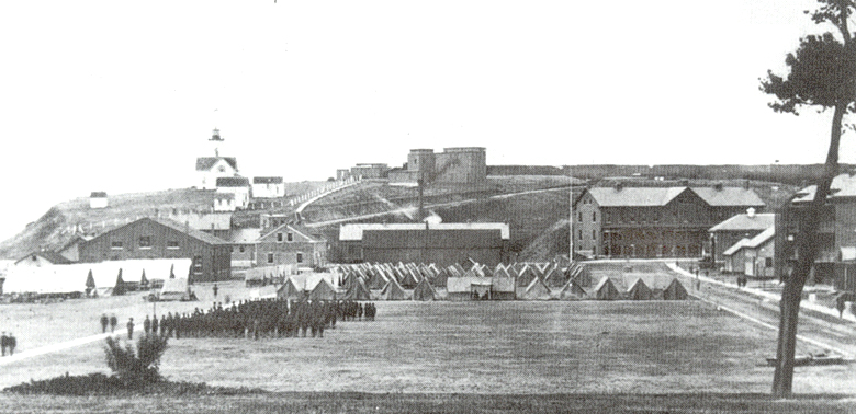
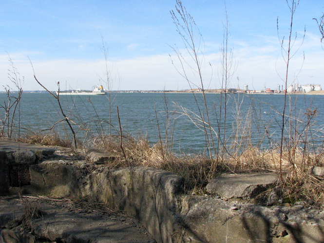
In its heyday, over 100 years ago, Ft. Strong on Boston's Long Island had one of the greatest concentrations of coast artillery in the Boston Harbor defenses. Today, in 2010, its concrete batteries stand derelect and decaying, cracked, and overgrown. But the history of the fort remains a thought-provoking journey, through the gun emplacements themselves, and into the nooks and crannies of the history of the Coast Artillery.

[NOTE: Access to Long Island is limited, and a manned guard house controls access to the causeway which is the only way to get there. The island is managed by the Boston Health and Hospitals Corporation, and hosts various human service and treatment programs, plus a large summer camp for Boston youth. ]

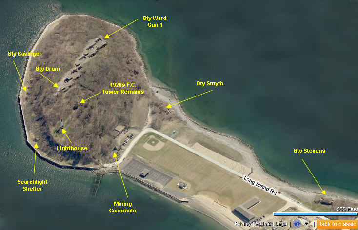
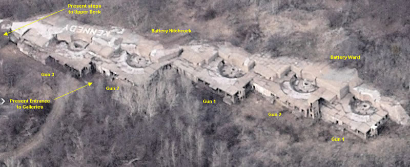
The fort was conceived as part of the Endicott System of coast defense, a nationwide construction program that began in 1890 and extended up through World War I. Construction work on the fort's major batteries, Hitchcock and Ward, began in 1893 and was completed by 1899. Five 10-inch guns were installed in a massive three-story concrete gallery which ran from Battery Hitchcock on the northwest (three guns) to Battery Ward on the southeast (two guns), and was concealed just behind the peak of the tall cliff at the northeast end of the island, about 100 ft. above the water.

The big guns were on disappearing carriages, dropping down behind the tall parapet for loading, and then revolving back up to peek over the parapet for firing. Once these big guns were installed, a pair of Armstrong 4.7-inch rapid fire guns on pedistal mounts was added (in 1898-99), creating Battery Drum on the northwest edge of Battery Hitchcock, looking down over the narrow harbor entry point between Long Island and Deer Island (Ft. Dawes).

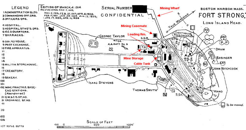
Then, in short order, four batteries of twin 3-inch guns were added for close-in defense of the mine fields and shiping channels near the island, and a large mine casemate was built to control all the mines in the sourthern approaches to Boston Harbor. By WW2, two of the 3-inch batteries (Stevens and Basinger) and the mine casemate remained on duty, but the other larger guns had all been decommissioned, victims of obselescence in the 'teens and 1920s.

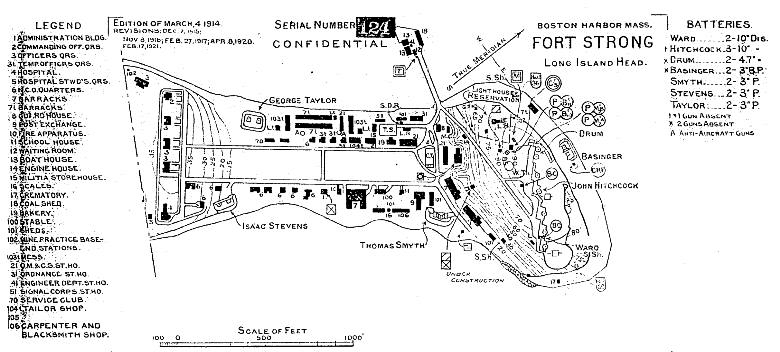
One hundred years ago, however, Ft. Strong held its own in the harbor arms race. Its 15 guns (not counting AA guns or guns under 3-inch calibre) rivaled the 20 guns at Ft. Standish on Lovell's Island, the 22 guns at Ft. Andrews on Peddock's (which included a total of 16 of the huge 12-inch mortars), the 16 additional 12-inch mortars at Ft. Banks in Winthrop, and the 10 guns of Ft. Revere in Hull.

Regarding old survey markers, the author has recently recovered three: MY4479 on top of the magazine of Bty Basinger, MY4579 on the floor of the Basinger CRF bunker, and MY0007 (central point and stem only), about 75 ft. NW of Gun 3 of Bty Hitchcock. MY4581, about 80 ft. N of Gun 1 of Bty Hitchcock, has been searched for extensively, but not yet recovered. The other marks previously set on the island are believed to have been lost.

For more details on Fort Strong's defenses, please see the sub-sections in the main menu underneath this section.

Maps and General Views of the Fort

  • Bing Map Looking Easterly
    This photo from Bing Maps looks easterly over the northern end of what used to be the parade ground of Ft. Strong. The zig-zag fortifications at top left are (W to E) the galleries of Btys Drum, Hitchcock, and Ward. The two 3-inch batteries that were active during WW2, Stevens and Basinger, are shown. The Mining Casemate has now been boarded up. The shearchlight shelter housed a 60-inch light that overlooked the mine fields to the west. In the years following 2005, the former parade ground was completely re-graded and filled, and facilities for a youth camp were constructed. The derelect old mining wharf at bottom left has now been replaced by a brand new pier to serve the camp.
  • Bing Map Looking Northerly
    The two gun pits for the 10-inch guns of Bty Ward and the three for Bty Hitchcock are clearly visible. Any given gun position has three levels: the lower (or gallery) level, which housed the magazines and generators, the gun platform level (with its depressed gun pits), and upper deck ( or burster layer) level. The gallery level is most easily acessed at the point indicated, where there is a broken gate in the fence, and is not continuous between gun positions. The upper deck can be reached by circling around the NW end of the fortifications, where steps lead up to the old Bty Drum and thence easterly down the length of the upper deck. The area is now even more heavily overgrown than shown in this image.
  • Ft Strong Map 1921
    By the time this Army map was made, the fort was already in technological decline. The legend shows the large variety of buildings present on the grounds, all the wooden ones of which have now been demolished. The mine observation station and the twin plotting and observation structures are indicated, and are noted as the "reminants" visible in the photo of Silde 1.
  • Map of Ft Strong 1938
    This map shows that by the eve of WW2, most of the older wooden structures at the fort had been destroyed. The facilities related to Ft. Strong's role as a mine depot and mine defense headquarters are highlighted in red. With the exception of the massive mining casemate, these were all destroyed during the recent construction of the summer camp.
  • Ft Strong C 1910
    This photo, looking northerly up the parade ground, dates perhaps from about 1910. The larger buiilding behind the tents at left is the mine (torpedo) storehouse. Further to the right are the bakery and then the cable tank for the mine cables. Up on the hill are the (now destroyed) wooden observation structures. The larger one at center right is probably the dual B'10/B'11 observation and plotting bulding, with the C'5 observation building to its left. Further to the left and behind (west of Bty Drum) is the dual mine spotting station M'2A/M'2B. (From Butler, Harbor Islands, p.29, with permission)
  • Mining Casemate
    Photo looks northerly from what used to be the parade ground (now a playing field). The mining casemate is on the left, and the fort's power station is on the right. Casemate was a massive bunker, bomb and gas-proof. Salmon-colored boards have been installed to secure structures from vandals and stray campers. The light of the lighthouse (with a conical, peaked top) is just visible through the gap in the left side of the top of larger pine tree behind the power station. (PG 2010)
  • Bty Taylor, Looking S
    This image looks south along the west coast of the former parade ground. Bty Taylor, dismantled before WW2, is at center. Officer's Row would have been visible just behind the battery. Long Island Hospital buildings, now housing social service programs, are to the right of the checkered standpipe, itself a well-known navigation point for mariners. (PG 2010)
  • Looking North From Bty Stevens
    Photo looks northerly from the shore in front of Bty Stevens. The lighthouse tower is in the distance at left, and the sun glints off the Battery Commander's tower of Bty Ward, at the peak of the ridge at center right (it's the leftmost vertical structure visible). The salmon-colored doors of the power station are visible in back of the climbing structure, which is part of the summer camp. (PG 2010)
  • NNE Twds Dawes
    This image looks NNE from the new pier (formerly the mining wharf). The egg-shaped tanks are part of the huge sewage treatment plant that now covers Deer Island, former site of Ft. Dawes and the Harbor Entry Control Post. The 60" searchlight shelter is just around the seawall to the right, with the two 3-inch guns of Bty Basinger about 200 ft. further past that. This channel was heavily mined, and guns from Ft. Dawes joined Bty Basinger in protecting the minefield. Past Deer Island to the NE is the open Altantic, where U-Boats patrolled early in the war. (PG 2010)