coast defense

Masthead Image

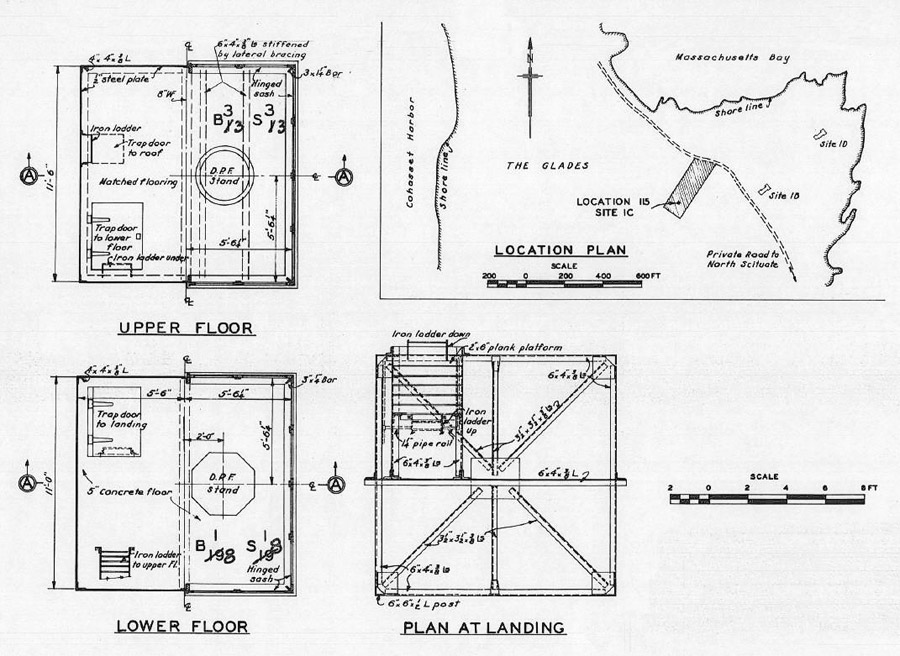
Strawberry Point: Central Towers

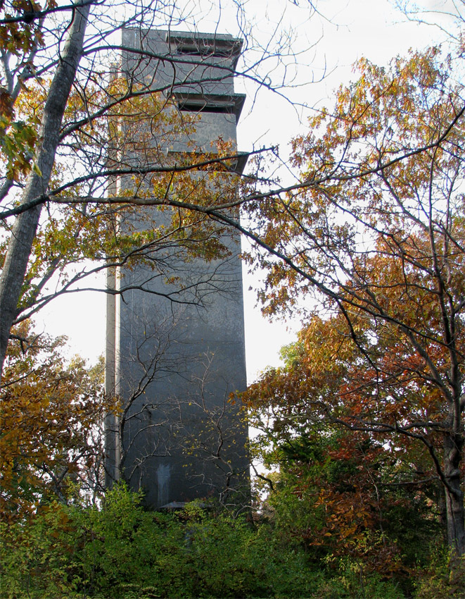
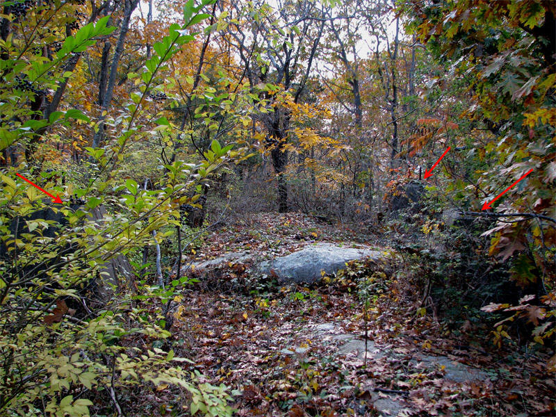
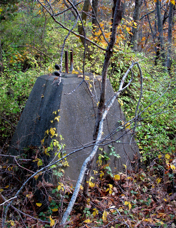
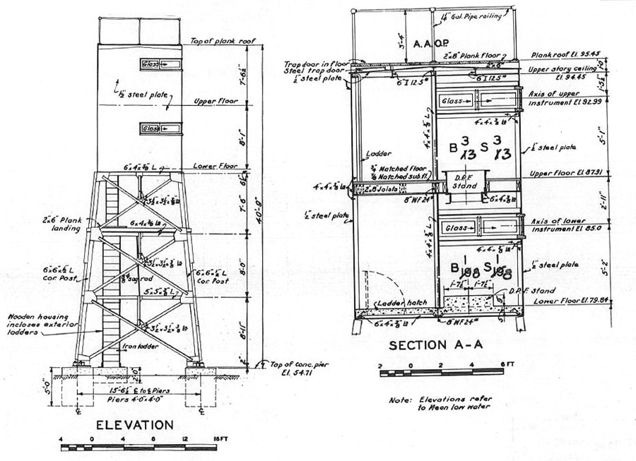
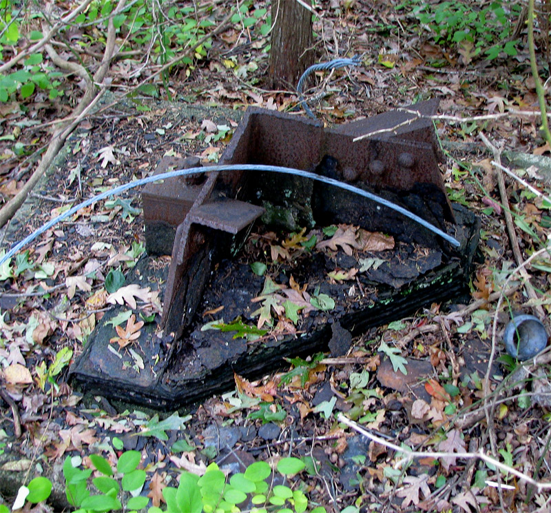
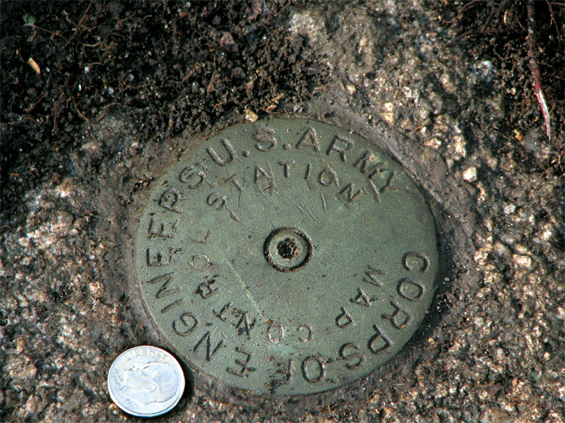
There were three tall towers on the ledges at the center of Strawberry Point during the war. The 8-story fire control tower (Site 1A) survives today, as shown in Slide 1 at left. The other two, a shorter, two-level steel fire control tower erected early in the war (Site 1C) and a steel radar tower for a target-tracking radar (Site 1E), were demolished after the war, and only their foundations remain.

Notice

  • 1A-Tower-Photo
    This concrete fire control tower is on the same plan as the two towers on Swallow Cave Rd. in Nahant, MA (see photo gallery there for details). The structure rises well above over the tallest trees on the Point, even 70 years after it was built. It is accessed via a woods road that braches southwesterly off of Glades Rd. (PG 2009)
  • Doorway-Disk
    This disk, located in the exposed ledge at the former door to the tall fire control tower, was set in 1943, the year the tower was completed. Known by the Permanent Identifier MY0089, the disk was used to locate the observing instruments in the tower. It is one of the steel disks used during WW2 while brass was rationed. The door to the tower (at right) was cemented-up after the war to secure the tower. (PG 2009)
  • Radar-Plan-&-Elev
    This drawing shows plan and elevation drawings for the 100-foot tall fire control radar tower erected about 70 feet WNW of the observation tower. The radar was known as SCR 296-3 (not 22 as noted on the plan) and was assigned primarily to track targets for the 16-inch guns of Btty Long in Hull. (US Army Corps of Engineers)
  • Radar-pylons-noted
    This photo looks westerly toward the four massive concrete pylons that once supported the radar tower. Three of these are barely visible through the underbrush, as indicated by the red arrows pointing at their flat tops. This photo gives a good idea of the forest canopy on the center of Strawberry Point and of the geology, with many exposed granite ledges. (PG 2009)
  • Single-Pylon
    This is one of the four pylons for the radar tower, which look like they were poured yesterday instead of 70 years ago, and still retain the mounting bolts used to secure the tower's base plates. (PG 2009)
  • 1C-Elevations
    These wartime drawings by the US Army Corps of Engineers show the steel fire control tower known as Site 1C, which was hurried into service three days before Pearl Harbor. It had two observation levels of about the same size as a those in a concrete tower. This was the only tower of its type known to have existed in the Boston Harbor defenses.
  • 1C-Plans
    These drawings show the plans for the two observation levels and the landing below them in the steel tower. Note the hatch to the roof, used for anti-aircraft observation. (US Army Corps of Engineers)
  • Obs-Tower-Base
    This photo shows one of the four remaining steel base plates for the Site 1C tower. The bluish stranded wire in the photo is a piece of the cable likely used during demolition of the tower. (PG 2009)
  • MY0088-Disk
    This Corps of Engineers geodetic disk (Permanent Identifier MY0088) marks the location of the tower. It was recovered (re-found) by the author in 2009, located 9.9 ft. northwesterly of the inside corner of the southwesterly tower support (shown in the preceding slide). (PG 2009)