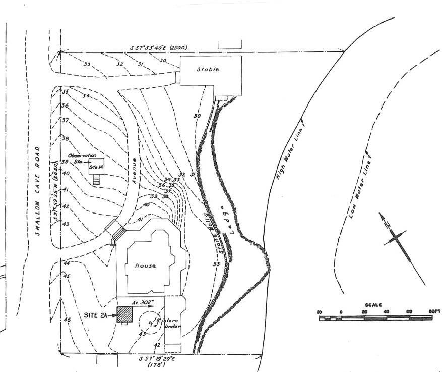
Swallow Cave Road Fire Control Towers
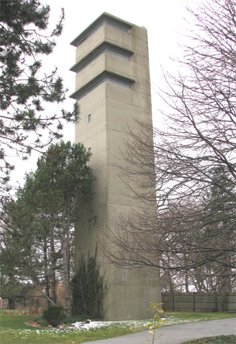
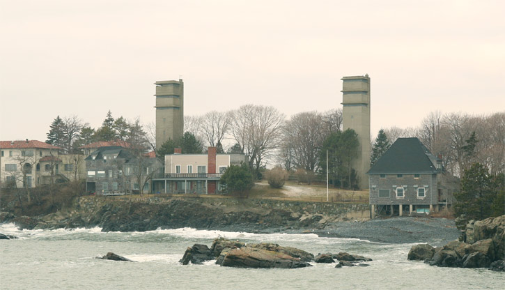
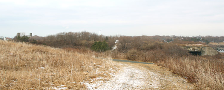
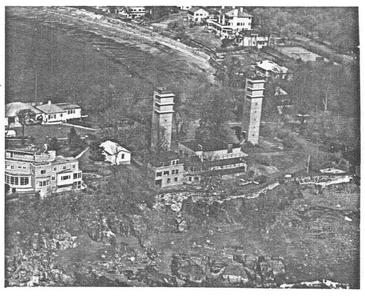
Erected during the winter of 1943-44, these two 8-story towers survive in excellent condition, about 120 ft. apart, on the southeast side of Swallow Cave Road (house numbers 9-11). The towers are on the southeast tip of Nahant, about 1200 ft. southwest of Battery Murphy. They appear to part of the same fenced property. The northernmost tower was known as Location 131, Site 1A. Its neighbor to the south was known as Site 2A.
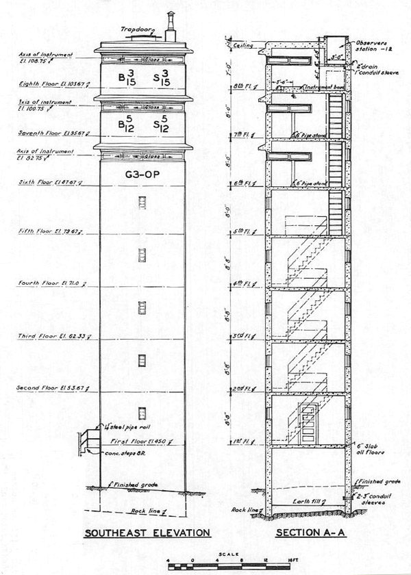
On the top floor of Tower 1A was a depression position finder (DPF) serving a base end station (B 3/15 S 3/15) for Location 206, the two 6" guns about 800 ft. to the east on East Point. The middle observation level (7th story) was indicated to be a station (B 5/12 S 5/12) for the two 16" guns that were planned ( but never installed) at Ft. Dawes on Deer Island. The 6th floor housed the observation point (OP) for the G3 Command of the harbor defense. The optical heights of the top three stories were 108.75, 100.75, and 92.75 ft.
Tower 2A had each of its top three stories equipped with an azimuth scope. Its top level was a base end station (B 4/16 S 4/16) for the 16" guns of Battery Murphy just to the east. Its 7th floor housed a base end station (B 3/14 S 3/14) for the 12" guns at Ft. Ruckman, and the 6th floor contained the Battery Commander's position for East Point's 6" guns. The observational heights of this tower were 108.75, 100.75, and 92.75 ft.
A site plan for these towers, plus a floor-by-floor plan, an elevation plan, and an elevation section for Tower 1A, are contained in the second photo gallery on this page, which also has a 1945 photo of the towers. All of these images come from the Nahant section of the 1945 Report of Completed Works by the U.S. Army Engineers. The first gallery shows current photos of the towers.
Troop quarters for both towers were located in the house adjacent to Tower 2A. This may in fact be the same structure now visibile on the site. An auxiliary 2.5KW generator in Tower 1A provided emergency power for both of the towers.
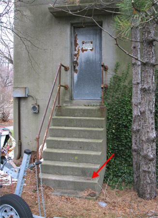
A geodetic mark (MY0050--H 16) is set in the eastern end of the second step to Tower 1A. This mark is one of the wartime steel disks that replaced brass while the latter was rationed. This disk was used to survey the location of the tower's observational instruments, which were marked by a disk (MY4762) on the tower's roof. During my site visits in December, 2009 and February, 2010, inside access to the towers could not be gained.